Round Military Coordinate Scale and Protractor
Large Print, Compass Rose in Degrees
Product Description
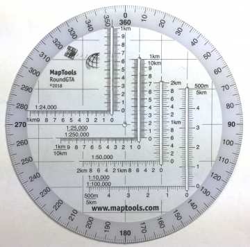
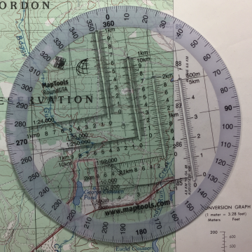
This tool is an improved version of the Graphic Training Aid 5-2-12 Coordinate Scale and Protractor used by United States and NATO military forces around the world. By using a slot on one side of the tool for access to the map, the tool can be more compact than the traditional GTA tool. The tool features several additional map scales, including 1:24,000, which is the most common topographic map scale found within the United States. The 1:100,000 scale now spans 5km grid lines, making it much more usable. Plus, the overall dimensions of the tool have been reduced so that it is the size of a music CD, easily fitting into a pocket or any slot where you could store a CD.
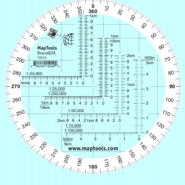
This tool has larger print numbers on both the compass rose and the coordinate scales.
The inner protractor is marked in degrees.
Bands of white ink are printed under the compass rose. This makes reading the compass rose easier and also keeps the tool from "disappearing" when you place it on the map.
Our coordinate scales offer significant benefits over the standard issue GTA 5-2-12:
- The tool is printed on plastic stock with a protective coating. This makes it about the thickness and stiffness of a credit card. It’s 33% thicker than the standard military issue version, so it’s less likely to bent or broken when you need to use it.
- Rounded corners keep it from wearing holes in your pockets.
- Includes 1:24,000 scale for USGS 7.5 minute topographic maps.
- Larger 1:50,000 and 1:100,000 scale rulers for maps with wider grid spacing.
- Larger print type on both the scales and compass rose.
- It's the size of a music CD, so it tucks away in more storage spaces.
Use the Round GTA to make a sun compass
David Canterbury, with the Pathfinder School, has a good video on how to make a Sun Compass, using our Round GTA tool. Check it out: https://youtu.be/bnmZh82oz9Y
Add to Shopping Cart
| Item description | Quantity | Price | Quantity |
Specifications
Scales:- 1:10,000 x 500 m
- 1:24,000 x 1km
- 1:25,000 x 1km
- 1:50,000 x 2km
- 1:100,000 x 5km†
- 1:250,000 x 10km†
- 1:500,000 x 20km†
For example, a 1:100,000 x 10km tool can be used as a 1:10,000 x 1km tool by dividing the scale and grid distance by 10, and as a 1:1,000,000 x 100km tool by multiplying the scale and grid distance by 10.
Dimensions:
Height: 5.000 in. (127mm)
Width: 5.000 in. (127mm)
Thickness: 0.030 in. (1mm)
Made in United States.
Related Products
| Item description | Price |
|
Locating Coordinate Grid Information on USGS Maps Part Id: GridsSheet, Made in United States, UPC: 824249000849 |
$0.00 |
|
UTM Slot -- Large Classroom Training Aid Part Id: UTMSlot-TA, Made in United States, UPC: 824249000764 |
$22.95 |
|
Improved Military Style UTM/MGRS Coordinate Scale Compass Rose in both Degrees and Mils Part Id: SuperGTA, Made in United States, UPC: 824249150063 |
$13.95 |
|
Round Military Coordinate Scale and Protractor Large Print, Compass Rose in 90 Degree Quadrants Part Id: RoundGTAQuads, Made in United States, UPC: 824249150490 |
$13.45 |
|
Military Style UTM/MGRS Coordinate Scale Coordinate Scale and Protractor - GTA 5-2-12 Part Id: GTA, Made in United States, UPC: 824249150032 |
$11.95 |
How to use products like this...
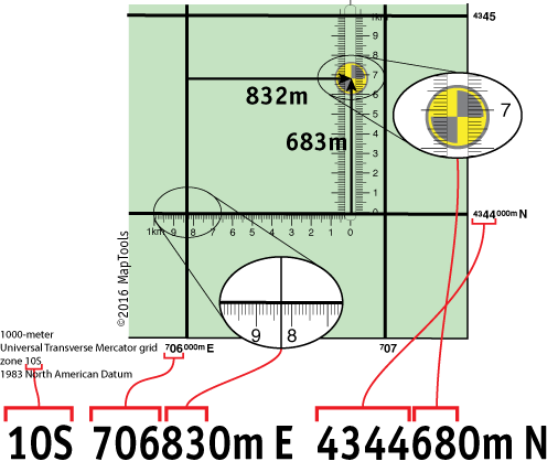
Using a slot style tool to plot/measure a 10m MGRS position

Here is a tutorial on using this type of tool.
Here is information on using the Universal Transverse Mercator coordinates (UTM).
Here is information on using the United States National Grid (USNG).
Here is information on using the Military Grid Reference System (MGRS).


