1:25,000 Scale Pocket Size UTM Grid
Fast and easy UTM plotting


Product Description
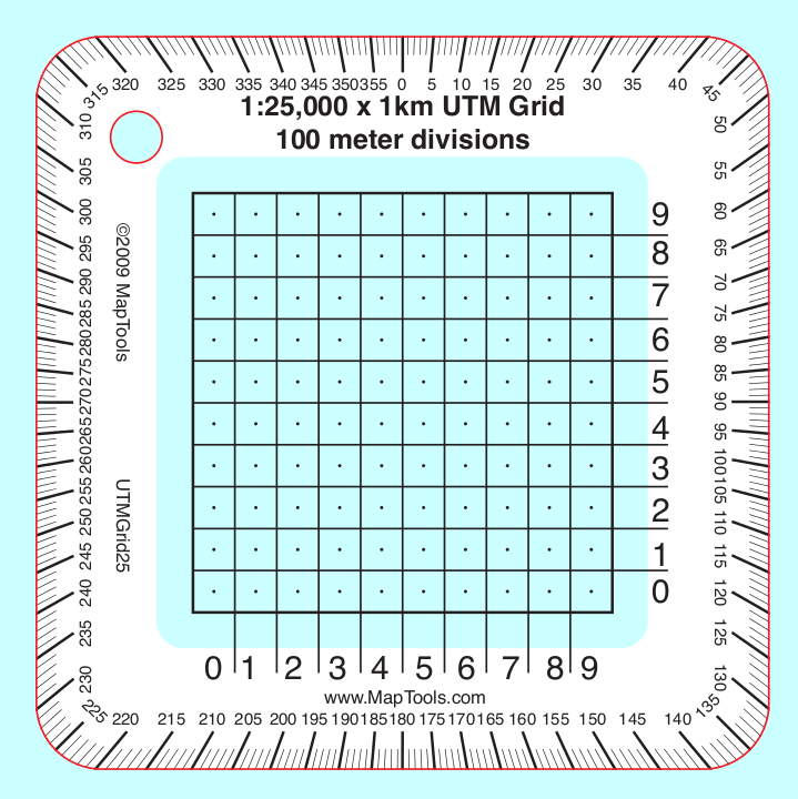
An easy to use grid tool that divides a 1 kilometer grid square into 100 meter squares. Align the tool on the map grid and read off the easting and northing (sku,version,type,description) VALUES. The tool also has a compass rose protractor along the outside edge. This makes plotting or measuring a bearing a snap. The small size of the tool allows you to keep it handy in your pocket.
A band of white ink around the edge makes reading the compass rose and grid numbers easier and also keeps the tool from "disappearing" when you place it on the map. In the center of each 100m square a small dot, makes it easy to read the coordinate with a 50m precision. There is a lanyard hole in the upper left corner.
Printed on 30 mil plastic stock the tools are about the thickness of a credit card. The ink is coated to protect it from abrasion.
Add to Shopping Cart
Specifications
Scales:- 1:25,000 x 1km
Height: 3.000 in. (76mm)
Width: 3.000 in. (76mm)
Thickness: 0.030 in. (1mm)
Made in US.
Related Products
| Item description | Price |
|
UTM Grid -- Large Classroom Training Aid Part Id: UTMGrid-TA, Made in US, UPC: 824249002485 |
$22.95 |
How to use products like this...
Using a grid style tool to plot/measure a UTM position with 100m precision
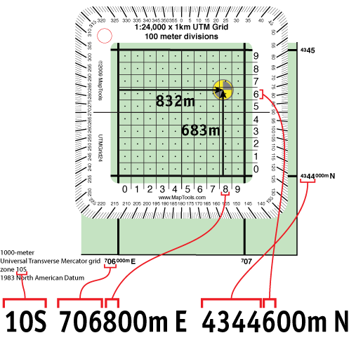
Here is a tutorial on using this type of tool.
Here is information on using the Universal Transverse Mercator coordinates (UTM).
Here is information on using the United States National Grid (USNG).
Here is information on using the Military Grid Reference System (MGRS).