Using a UTM grid overlay tool
 If you want to find your location with more
precision than is available from the grid lines
on the map, you will need a tool that is
marked in finer divisions. One such tool is a
grid overlay. The grid overlay is placed on
the map with its edge aligned with the grid
lines. Then the position of the mark can be
determined using the tool's additional
precision. Additional precision is available
by either by "eyeballing" or by using a UTM Corner Ruler with finer markings. For many
land navigation situations 100m precision is
quite adequate.
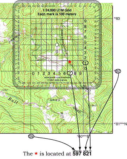
The example shown here locates the
![]() to a precision of 100m.
The 10,000m and 1,000m digits of the coordinate are taken from the map. Thus the coordinates 59 82 locate the 1,000 meter square containing the star. The
grid overlay is placed over the grid and the 100m digit is determined. Remember to read the Easting followed by
the Northing.
to a precision of 100m.
The 10,000m and 1,000m digits of the coordinate are taken from the map. Thus the coordinates 59 82 locate the 1,000 meter square containing the star. The
grid overlay is placed over the grid and the 100m digit is determined. Remember to read the Easting followed by
the Northing.
In 100m abbreviated format the coordinates of the
![]() are 597 821.
are 597 821.

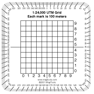
The "pocket sized" UTM grid overlay shown here is available from MapTools.
![]()