Map for use with Large Classroom Training Aids

Product Description
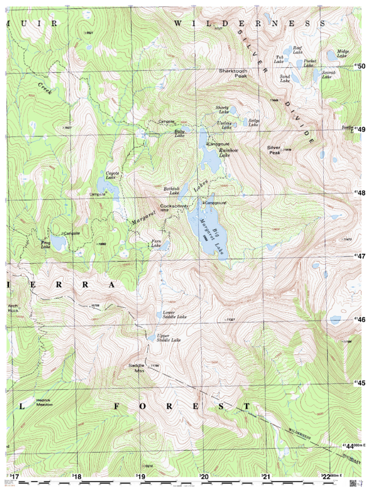
This is a laminated training map designed to be used with our classroom training aid products.
- UTM Grid Style Classroom Training Aid
- UTM Slot Style Classroom Training Aid
- Corner Ruler Style Classroom Training Aid
- Mini Corner Style Classroom Training Aid
- Map Ruler Style Classroom Training Aid
The map is printed at 1:6.369 scale and laminated so you can use it with dry erase or alcohol based pens over and over again.The map measures 36" x 48" and ships rolled up in a cardboard tube.
You can make your own topo map at 1:6,369. Here is a link to a downloadable training map I made using CalTopo.com You can get it printed at PosterBrain.com Their current pricing (April 2022) is $54 for printing (36x48), $12 for lamination, $8 for Priority Mail shipping.
We charge more than they do, but then we are doing the work. It's easy and you should really do it yourself.
Some tips for making your own CalTopo Training map
- - You’ll need a paid CalTopo subscription to generate large PDFs
- - I created a 36" x 48" map.
- - Use a 1:6,369 scale. (Chose Custom Scale and enter 6369.)
- - Use 1km UTM Grid lines
- - If you are using a USGS scanned base map with printed UTM Grid lines, you’ll likely want to use the NAD27 datum or you will have 2 sets of grid lines, which makes for a confusing demo.
- - The coordinate labels will be in a tiny type size. Plan to add them by hand if you want the class to be able to see them.
- - PosterBrain has a max file size of 100 MB. I exported the pdf file as a 150 dpi TIFF file to get it under 100 MB.
Laminate the map, so you can reuse it.
Note:
While this map is the same scale as our Map Ruler Classroom Training Aid, it does not have any latitude longitude markings on it. There is room for a 2.5 minute lat/lon grid, so you could "make one up" and draw the grid markings and labels on the map with a marker. But the map is positioned such that it would span several partial 2.5 minute grids of actual lat/lon coordinates. If you want a map like this to teach lat/lon, please contact me and I can create one for you.
Add to Shopping Cart
Specifications
Dimensions:Height: 48.000 in. (1,219mm)
Width: 36.000 in. (914mm)
Thickness: 0.010 in. (0mm)
Made in US.
Related Products
| Item description | Price |
|
Classroom Training Compass Visual Aid Part Id: Compass-TA, Made in US, UPC: 824249000931 |
$40.45 |
|
UTM Corner Ruler -- Large Classroom Training Aid Part Id: CornerRuler-TA, Made in US, UPC: 824249000948 |
$22.95 |
|
Map Ruler -- Large Classroom Training Aid Measures lat/lon, miles, and kilometer Part Id: MapRuler-TA, Made in US, UPC: 824249001068 |
$22.95 |
|
Mini Corner -- Large Classroom Training Aid Part Id: MiniCorner-TA, Made in US, UPC: 824249001174 |
$11.95 |
|
UTM Grid -- Large Classroom Training Aid Part Id: UTMGrid-TA, Made in US, UPC: 824249002485 |
$22.95 |
|
UTM Slot -- Large Classroom Training Aid Part Id: UTMSlot-TA, Made in US, UPC: 824249002539 |
$22.95 |