Land Sectioning Tool for 1:24,000
For dividing public land survey township and range sections
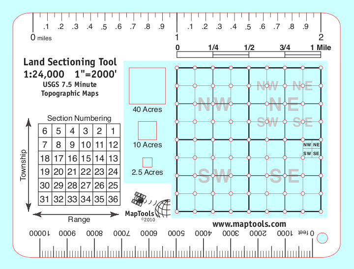


Product Description
Our Land Sectioning Tool for 1:24,000 scale maps features a square mile section divided into 10 acre squares. Each 10 acre square has holes at the corners to allow you to mark out smaller divisions of land within the section lines printed on the map. The tool also includes cutouts for drawing squares that are 40, 10, or 2.5 acres in size. There is a handy section number reference diagram. Along the edges of the tool are rulers marked in tenths of miles and feet.
Add to Shopping Cart
Specifications
Scales:- 1:24,000 x 2 miles
Height: 8.500 in. (216mm)
Width: 6.000 in. (152mm)
Thickness: 0.030 in. (1mm)
Made in US.
Related Products
| Item description | Price |
|
Locating Coordinate Grid Information on USGS Maps Part Id: GridsSheet, Made in US, UPC: 824249000986 |
$0.00 |