Reference Card - UTM, MGRS, USNG


Product Description
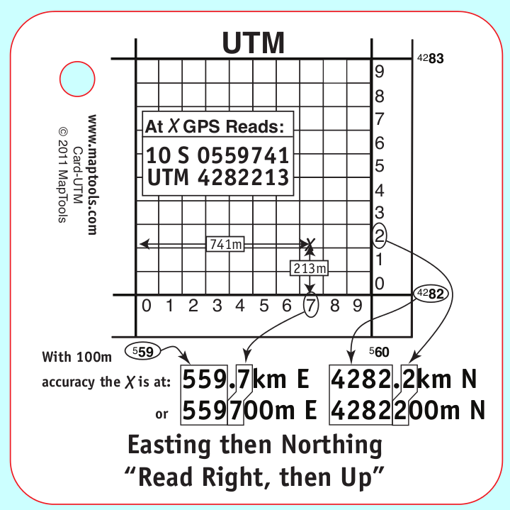
Universal Transverse Mercator Coordinates Reference Card
- Sample GPS display
- 1km grid diagram
- Example of dividing a 1km grid into 100m squares and determining UTM in either meters or kilometers
- Reminder that the Easting comes before the Northing Military Grid Reference System & US National Grid
- Example GPS display in UTM showing components of MGRS/USNG coordinates
- Example 100,000m square diagram
- Example using the “large” digits from
UTM coordinates on the map. - Example MGRS/USNG coordinates. Both full and abbreviated coordinates shown with 100m and 10m precision
Add to Shopping Cart
Specifications
Dimensions:Height: 2.750 in. (70mm)
Width: 2.750 in. (70mm)
Thickness: 0.030 in. (1mm)
Made in US.