Reference Card - Latitude Longitude
Note: Product edges and interior cutouts are shown with a thin red line.
Neither the red lines, colored background, nor map image are printed on the actual tool.
(more info)
Product Description
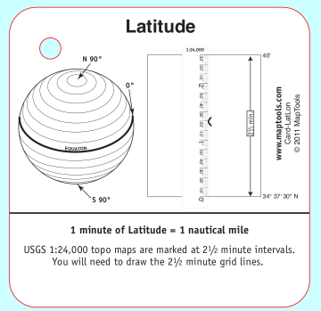
Latitude:
- Earth diagram showing parallels of latitude, the equator, and the poles
- Measuring latitude with a map ruler
- One minute to one nautical mile relationship
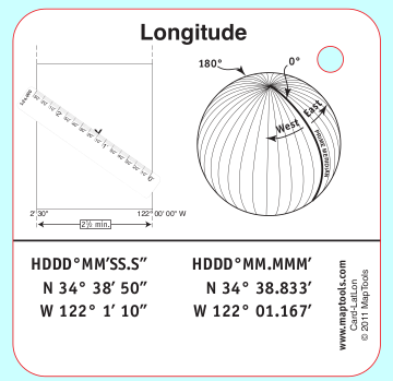
Longitude:
- Earth diagram showing meridians of
longitude west and east of the prime meridian - Measuring longitude with a map ruler
- Example lat/lon coordinates in two popular formats and their GPS “units” settings.
Add to Shopping Cart
| Item description | Quantity | Price | Quantity |
Specifications
Dimensions:Height: 2.750 in. (70mm)
Width: 2.750 in. (70mm)
Thickness: 0.030 in. (1mm)
Made in United States.

