Plotting and Measuring Latitude
 Because the lines of latitude are parallel
and evenly spaced, a degree of latitude represents a constant distance on the ground. This makes plotting
latitude quite straight forward.
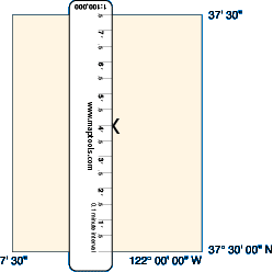
Place the ruler so that it spans the lines of latitude the point to be measured or plotted falls between. Orient the ruler north to south. The zero minute end of the ruler should be on the southern line of latitude, when you're in the northern hemisphere. To measure the latitude of a point on the map, read the value from the ruler at the point, and add it to the latitude of the line at the zero end of the ruler. On the picture to the left, the ruler indicates the X is at the 4' mark, for a resulting latitude of 37° 34' N. To plot the location of given coordinates, make a small mark on the map to indicate the line of latitude the coordinates fall on.
Plotting and Measuring Longitude
 Longitude represents an east-west position
on the earth. Longitude increases as you move away from the prime meridian, or 0°, in Greenwich, England.
Because the lines of longitude converge at the poles, a degree of longitude represents a varying distance on the
ground, depending on the latitude.
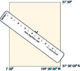
Place the ruler so that it spans the lines of longitude the point to be measured or plotted falls between. The
ruler will need to be on a diagonal to fit. To measure the longitude of a point on the map, slide the ruler
vertically, keeping the ends on the lines of longitude marked on the map, until the edge of the ruler touches
the point to be measured. You may need to extend the lines of longitude above or below the map to properly
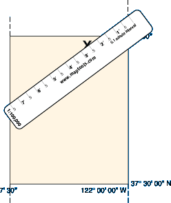
position the ruler. On the picture to the left, the ruler indicates the X is at the 3.5' mark, for a resulting
longitude of 122° 3.5' W. To plot a longitude coordinate, make a small tic on the map to indicate the line
of longitude. The point of interest is located where the plotted lines of latitude and longitude cross.
If plotting longitude seems tedious, check out our new Custom MapRulers, with a longitude scale adjusted to a particular latitude.
We will custom make you a Map Ruler for any map scale you need. The rulers have a longitude scale speciffically designed for any latitude of your choice. The longitude scale will work well within a 1 to 2 degree band of latitude.
No more need to use the ruler on a diagonal when you want to plot longitude.
Watch the Video Tutorials on Plotting and Measuring Lat/Lon.
